Allalinhorn, 4027m. Saas Fee
 |
| The Allalinhorn |
 |
| The Allalinhorn (near the summit) |
Today we had our most intense adventure for the trip to Saas
Fee. We signed up for a guide hike to the top of Allalinhorn, one of the easier
hike that one could do as a day hike. We engaged the service of an outdoor
activity in Saas Fee called the Sass Fee Guides. For the climb you will need to
get the needed equipment to do the climb as you will hiking up snow covered
grounds. Aside from the proper clothing for the climb, the basic items are
crampons, harness and hiking pole with ice basket of ski poles. The last few items you can easily rent from
the sporting shops at Saas Fee for a fee of about CHF$25 (good at time of
writing). For us, we brought out gear all the way from home just for this
climb. We paid for the climb fee a day before the climb date and had our
briefing shared with us at the guide office located within the town area. It took us some time to find the retail style
office. Must be all the distractions from the cafes and restaurant and sport
shops.
 |
| Me, making our way to the Alpine Express cable car station at Saas Fee |
 |
| My trusty hiking pole of 10 years and more years to come |
The start point of the climb will be at the 3500m altitude
at the station of Mittelallalin but our meeting point was within the Saas Fee
village at the Alpine Express cable car station. With the Citizen Pass that we
had because of our accommodation stay and the tourist tax provided the pass, we
would still need purchase the ticket extend that allowed us to travel from
Felskinn station at 3000m to the Mittelallalin. The additional ticket purchase
was just showing the ticket sales staff our citizen pass and they just added
our bar code pass into their system to allow us to reach Mittelallalin.
At 8am, we met the guides, and a quick welcome and off we
with the rest of the climb group boarded the early morning cable car to the
mountain. We switch 2 cable car at different station and the final one was a funicular
tram that climbed steeply into the final station of Mittelallalin at 3500m. The
snow fields were open that day and snow boarders, skiers were there taking the
chairlifts up the slope area. It was not the peak season and crowd was minimal.
 |
| In the cable car making our way up the mountain (village of Saas Fee below) |
 |
| The 2 experienced guides |
 |
| A quick photo shot of the clouds over the mountain in the morning (cloud and sun day) |
 |
| Taking the tunnel at Felskinn station from the cable car to the Furniculat tram. |
 |
| All aboard to the 3500m high station. |
Once we reach the highest station of Mittelallalin, a quick toilet break, and afterwards we strapped on our waist harness and crampons and off we set
off to the peak. It was only a short distance from the station that we did out
first step on snow. From there we walked on the snow grounds used by skiers
towards the distant snow slope that broke away from the wide ski field area.
There was much traffic from the skiers and so at places where we need to cut
across the skiing path.
 |
| Exiting the Mittelallalin station. Less cloud here but just blue skies |
 |
| Walking on soil, rocks with crampons strap on seems damaging the crampons |
 |
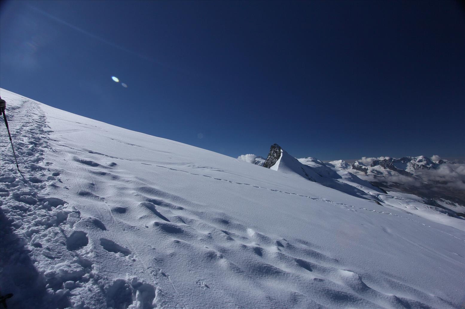
| 1st step on snow ice. The Allalinhorn right in the centre of photo. |
 |
| Getting warm up from the walking on snow and ice. |
 |
| Approaching the snow wall (part of ski path) |
 |
| Watching out for skiers' traffic. Dont get crash by them |
 |
| Cutting across the ski field paths (air ambulance approaching) |
 |
| An air ambulance, someone was injured and sitting at the level ground area |
 |
| Strapping all of us group into 2 groups |
It took about 20 mins of walking on the snow field that we
reach the breakaway point. The guide hooked up all up in a rope system where 4
of us were strapped to each other. There were 2 groups that were form and each
guide took the lead leading the smaller group.
We were in the first group and from the point we left the snow field
path, it was all the way traversing the slide of the mountain slope to gain
altitude.
 |
| All strapped up and the climb on the snowy slopes began |
 |
| Quick shot of myself. |
 |
| Looking back at how much we climb. Station seems so far |
The gradient was steep and too difficult to just cut across and head
straight up. This is a popular route for
climbers and the snow path was already clear and distinct. Previous climbers
that did the climb, I supposed help to keep the trail in usable state such that
lesser effort is needed to scale. There
was no rest stop and the guide just continued on and on.
 |
| Up we climbed the wooden ladder |
We came a section that required some ladder
climbing on all fours. I guessed this is the most practical and sensible route,
if not the local authority would not build this permanent wooden structure.
Looking at the wooden horizontal beam, we could see the “injuries” that was
inflicted by the use of crampons on them. Well this was the only place that we
had a chance to rest for a short moment while scaling up. There was heat blower
machine just besides the ladder area. I guessed it was used to melt the snow on
the wooden structure to keep usable and safe.
The structure leaned on the rock wall in a steep manner that an
overnight snowfall could cover it up.
 |
| The sun like a shinning star at the summit of the Allalinhorn |
 |
| Looking back at the station again just to see how high we climbed |
 |
| Our other group following close behind |
 |
| Almost reaching the saddle of the mountain spine to Allalinhorn |
 |
| Always no easy gradient to climb |
After clearing the wooden ladder, it was again traversing
along the side of the steep snowed covered path without any rest stop until we
reach the saddle of the mountain. The ground area offered some flatness and a
good stop for a quick rest and water break. At this point we had a 360 degree
view of the mountain peaks around us, and the peak of Allalinhorn is within
sight.
 |
| At the rest point on a open flat surface. |
 |
| A vast 360 view of the surroundings mountains |
 |
| 2nd group reaching the rest point as well. |
 |
| Me an Wifey |
We left the rest area after 10mins and headed towards the
black rock surface area of the summit which was the easier and more gentle
ascent to the summit. Read about approaching the summit of Allalinhorn from
other side but is much more technical and difficult. As we approached closer to
the summit, we could see the summit cross planted at the top and some climbers
were already there. The section of the route before the summit was the black
rock area which wasn’t covered in snow at the time of our climb. This was the
only black area that we could see from town. We had to walk on the rock part
before reach another small flat area before going on the narrow ridge line that
leads to the summit marker. At the rock path area, care has to be taken not to
damage our crampons as it is not intended for crampons to walk on rocks. It was
build for snow and ice, and expected much scratches and paint chip off using
crampons for this part of the climb.
 |
| More snow to climb and it never get leveled |
 |
| Finally able to see the summit (black rock part) |
 |
| Making a zig zag path up the slope to the summit |
 |
| View of somewhere else with the summit to the left. |
 |
| Getting real close now. Less than 1km |
 |
| Going behind the summit to scale up |
 |
| Rocks and snow. Watch your steps |
 |
| Reaching the open flat area after the rocks |
Once we cleared the steep rock path, we
entered onto a large flat ground area that was used by other groups already
there for resting after getting to the summit market. From this rest area, up a
easy 2 meter snow wall and there we were on the narrow snow ridge line walking
towards the summit marker. Both sides were moderately steep and care has to be
taken not to slip over. It was a short maybe 30 meters and we were finally
there.
 |
| Finally, a few more steps and onto the narrow ridgeline to walk over to the summit marker |
 |
| Walking on the ridgeline to the summit marker. |
 |
| Finally at the summit |
 |
| Our 1st group of 4 at the summit |
 |
| All still strapped up, couldn't walk away too far. Quite small area at the summit |
At the summit of Allalinhorn at 4027m. The summit area was small and the
summit marker (a cross) was mounted on a rock pile and required some simple
climbing up to be next to the market. With our ropes still attached to us, it
was not so easily to move around while all tied up to each other. There was
still some risk on such a snow capped mount summit and so all of us have to
remain with the ropes attached and with our crampons on. The summit area was
small and so have to make room for other groups for their share of photo taking
time at the summit. We took many pictures at the summit market before walking
back along the narrow ridge line path to the rest area just below .
 |
| Leaving the summit behind us to the rest area in front |
 |
| Photo with the guide before going down to the rest area |
At the rest area, it was there where we had our longer
break. The guides had sat down to drink and snack, a sign that we have made the
objective of the climb and what was left was just the descent. We had a small
of coke and some bread while enjoying the surrounding view. The guide did also
share with us the mountain peaks that were near us, like the Monte Rosa, and
the distant famous Matterhorn which you couldn’t tell from this point to it.
The part of the Swiss Alps marks the border as well to the neighbouring country
of Italy. One can actually enters into Italy from Zermatt via the cable car and
gondola and some walking over the snow field to the Italian side of their
mountain top station.
 |
| At the rest area |
 |
| Loading up some sugar |
 |
| Another Wefie |
 |
| Altimeter check ( summit is 4027m, we dropped a few meters down to rest area) |
 |
| Everyone enjoying the view and their successful access to the summit |
 |
| View of the mountains beyond (pic taken at the rest area) |
After a good 30 mins break, we were organized up again and
started the descend with the guide taking the rear position and one of our small
group member taking the lead down. This was a one day non stop down all the way
without any rest stop. The descent was stressful for the knees and legs, cardio
was fine since it was a descend, but it was no easy task as well. The pace was
much faster and me and my wife had a hard time fighting the muscle ache and
cramps on the legs. Maybe for me started the descend using the wrong method and
so the thighs just cramped up. After a while the numbness took over. It seemed
forever but in actual fact it was fast and in an hour time we were back at the
snow field ski area.
 |
| Having some difficulty untangling ourselves |
 |
| 2 way traffic. |
 |
| Last men now becomes the front man |
 |
| Back at the wooden ladder |
 |
| Back at the ski field area and we are "detached" |
The guide removed the ropes on our harness and we bid
farewell to the guide so that we could enjoy our slow walk back to the cable
car station of Mittelallalin which was in constant sight of it.We just follow
the main ski path and cut across a few chairlift and ski lift path and we were
back at the tram station for lunch.
 |
| Enjoying a slow and relax walk back to the Mittelallalin station |
 |
| Tempting to just cut across the snow field. But stick to the ski path. |
 |
| Where have all the skiers gone? |
 |
| The station is in sight. |
 |
| Repacking our gear back into the same small backpack |
 |
| Drying up the washed crampons |
 |
| Drinks at the rotating restaurant with view of the Allalinhorn |
 |
| The Allalinhorn again. View from the restaurant |
 |
| Almost finishing up the food. Hungry. |
There is an amazing rotating restaurant at the station
itself that serve cooked food. There is a restaurant at the rotating deck, while
the lower deck has a self help cafe. Within the building structure, there is a
glacier world museum. We did not spend for the admission tickets because it was
quite late and left only an hour to tour the place after our relaxing lunch. Back
at the station, we took some time to clean up the gear like crampons and boots
and repacking the hardness and clothing up. I think it was around 1:30pm when
we started our long lunch and finishing only about 2:45pm. The rotating
restaurant allowed us to enjoy our meal while having the mountain view moving
slowly round us. It took about an hour to have a full 360 turn. We got to see
the Allalinhorn that we had just scaled, enjoying it over food and drinks.We
took the 3pm tram down from Mittelallalin to Felskinn at 3000m and back to the
Alpine Express station at the village of Saas Fee.
 |
| Taking the cable car back to Saas Fee |
 |
| We could see our hotel from here |
 |
| At the AlpinExpress cable car station |
 |
| Strolling back to our hotel nearby |
 |
| Our dinner at the same place opposite the Bristol Hotel where we stayed. |
This is a climb that I always wanted to try, a climb that
can take me to the top of a snow covered mount summit. Something that is not
too technical or difficult for me as I am still considered more of a casual
climber than professional one that handles ropes, belaying systems. So this was a one item must-do list being
marked as ticked and done.


No comments :
Post a Comment