27 May 2011, Driving into the Jotunheimen National Park
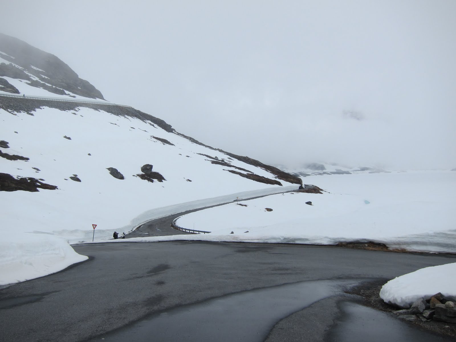
Today was still a cloudy day at Geiranger and we heard from the campsite staff that Geriranger has been having weeks of bad weather, only glimpse of sunlight. We were lucky to catch some sunlight while boating along the Geiranger Fjord. We left the campsite in our car around 9am, taking our own sweet time to pack. We took the same route 63 up the steep road again from the town centre up to Dainibba. Again we were greeted by walls of tall snow and when we reach the Djupvasshytta (1030m) souvenir shop near the Dannibba, it was packed with tour buses with tourists. Everyone was out on the road taking pictures of themselves with the snow walls. It was all written with messages by tourists like graffiti. A good place for toilet breaks for those who drove up the winding steep road from Geiranger. Because of the touristy nature of the place, we parked our car above the shop and played with the snow and of course joined in the snow wall graffiti.
 |
| Djupvasshytta at 1030m. A tourist bus stop |
 |
| Loads of tour bus with tourists |
 |
| The road on route 63 going to Lom |
 |
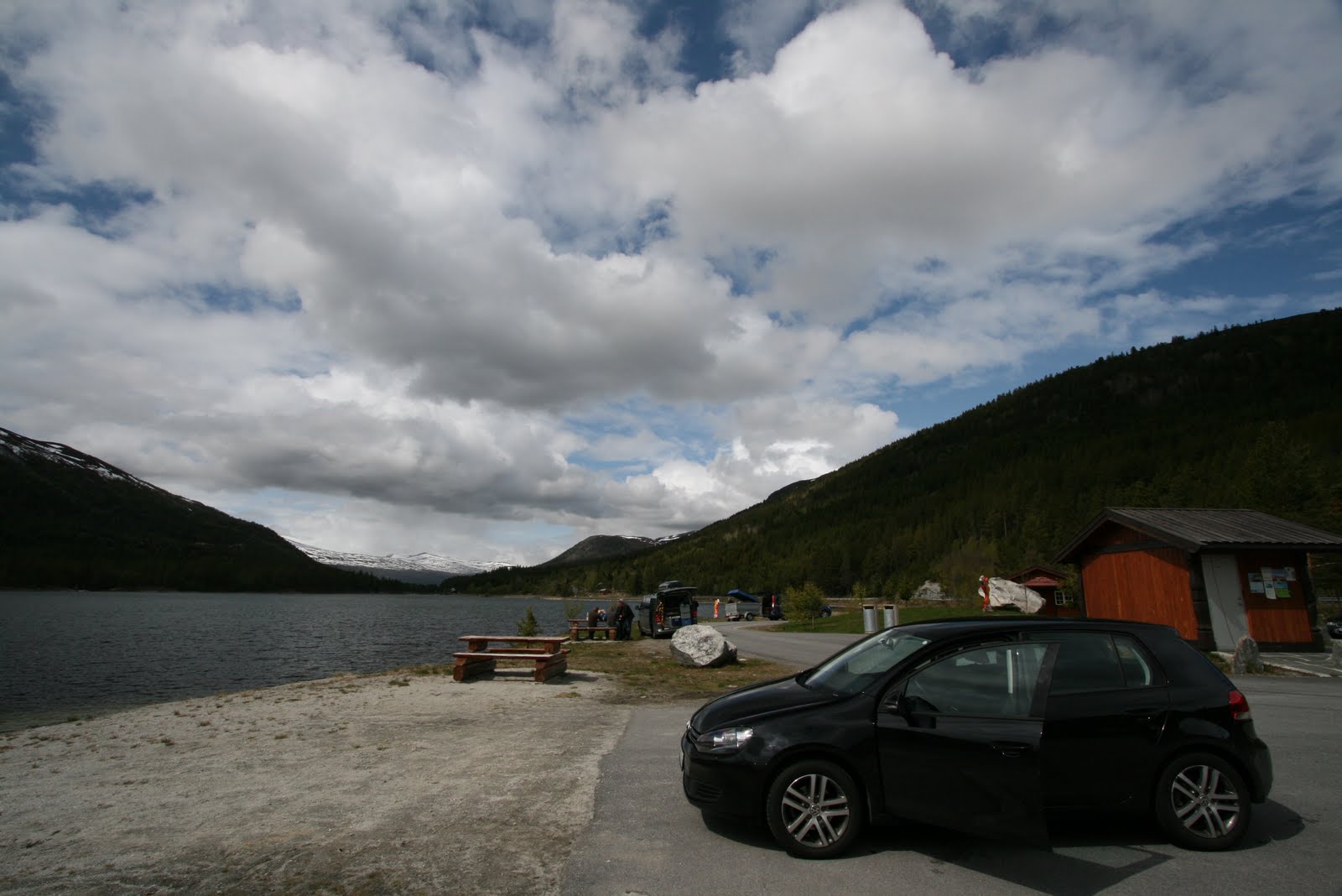
| From snow to sunny weather. A rest stop along route 15 near Lom |
Around 2pm with a slow drive, we were back in the village of Lom and had lunch at one of the cafeteria there. Nothing much left to do, so we went to our favorite pastime while overseas on holiday, visiting the supermarket again (COOP). But this time it is really to stock up food for the next day climb to the roof of Norway, the Galdhøpiggen.
 |
| Lunch at Lom restaurant, stir fry vegetables |
 |
| Lunch at Lom, cabonara |
With no plans for the day, we took on the route 55 and turn into the mountain road at Gladesand. The mountain climbs steadily up to an automatic toll gate just located after the entrance to another mountain lodge, the Raubergstulen. The automatic tollgate accepts credit card payment and coins only. We had to pay twice because the 1st payment, the gate barrier went up but when we started the engine (both of us got off to examine how to work the tollgate) and before we could drive through it came down again. Luckily the staff at the Juvasshytta mountain lodge offset the double charging when we checked in. The staff says that this is a common problem and we were not the first victim.
 |
| After toll gate, the alpine road to Juvasshytta. Just only us |
 |
| Altitude when we reached the Juvasshytta mountain lodge |
The mountain road that we drove on during this time of the year was covered in many areas with snow, except the road that we drove on which was cleared by Juvasshytta staff using bulldozer and snow clearing machinery. During the drive, it seemed that we were the only ones on this mountain road leading to the lodge at 1800m.
 |
| Snowing at the mountain lodge (taken inside car) |
 |
| Entrance to the Juvasshytta mountain lodge |
The lodge provides dinner at a cost but we went prepared with some home brought instant cup noodles and some grilled drumsticks that we bought at Lom's supermarket. It was actually quite enjoyable to have a taste of home food up in the mountain at 1850m with snow blowing outside our room window.
 |
| Home flavours all the way from Singapore |
 |
| Chips, Vodka with lemon, car keys and altitude where we are |
 |
| Our nice warm room. Still snowing outside |
We turned in earlier for the night in anticipation for tomorrow's morning climb.
28 May 2011, The Climb to the Roof of Norway, The Galdhøpiggen (2469m)
Please click on the below link for the posting on climbing the Galdhopiggen.
http://peanutstravels.blogspot.com/2011/06/climbing-galdhpiggen-norway.html
29 May 2011, A visit to Trollstigen and the Atlantic Road
 |
| Where we stayed |
 |
| A fine day to do sightseeing |
Today was a great day, the sun was up and shining and the skies were blue. All the grass around our campsite were in pure greenery. With the yellow rape flowers and the steep mountain walls, the setup was perfect and yes I began my photo snapping everywhere. Spotted one of the rabbits running across the compound which could not be found later as we searched the campsite grounds for them.
 |
| Yellow flowers along the road. |
Our first visit today was the well-known Trollstigen road and the Stigfoss Brua waterfall along this road. It was just a 20min drive from our campsite to the steep mountain wall with the zigzag road. As it was Sunday morning, there were little traffic and no tour buses on this road, giving us ample time to just stop our car by the roadside to enjoy the scenery. As this was spring, the mountain top was still covered in melting snow and the waterfall was in full power.
 |
| The Stigfoss Brua (Stigfoss Waterfall) |
 |
| The waterfall |
 |
| Looking down at the Trollstigen road |
After a photo shot at the bridge over the waterfall, we continued to the top of the road which has some modern architecture building in construction. The man made path leading to the glass wall viewing platform was completed, only left the entrance part near the main road which was still undergoing some renovation. As this was still late spring, the snack bars and souvenir shops down the road were still closed. There was only one shop that was opened with all his wares laid out nicely attracting tourists. We took the path down to the extended structure over the ledge, giving the best view of the zigzag Trollstigen road. This road only opens in late spring and summer, and closed during the winter months.
 |
| The Trollstigen Road |
 |
| Extended structure over the cliff to give unblock view |
 |
| Only shop opened at this time of the year |
After spending in total an hour around the top of the road, we headed back downhill towards the direction of Andalsnes which is just a few kilometers from our campsite.
Our 2nd destination visit would be the Atlantic Road near Kristiansund. On map the fastest way from Andalsnes to Atlantic road is to take the ferry from Afarnes to Solsnes and then via Molde and route 64 to reach the tourist route of Atlantic road. Wanting to save some cost on ferry, we took the land route along the coast that run from Afarnes to Eidsvag on route 660. From Eidsvag, we followed the route 62 into Molde and turning on the 64 to reach the Atlantic road. It was a long drive and an additional duration of 1.5hrs. I would say taking the ferry would be better choice. Around 1pm, after a 2.5 hrs. drive from Trollstigen, we reached the Atlantic road and drive up the famous bridge, the Atlanderhavsvegen.
 |
| At the Atlantic Road |
 |
| The Atlanderhavsvegen bridge |
We started to see campervans and tourists parking their vehicle on the narrow strip of land along this road. Being a road built out into the sea, the winds are strong and little place to seek refuge should the weather gets bad. After taking some photos, we were off on our way to our accommodation at Alesund. The distance to Alesund from Atlantic road is not that far unless you intend to drive a big round. Taking the ferry at Molde to Vestnes is the fastest way. We drove back to the town Molde and straight to the ferry point just outside of town. Ferry schedule was frequent in intervals of 30mins even on a Sunday afternoon.
 |
| The ferry just left |
 |
| Here comes the ferry at 4:45pm |
When we reached the jetty, a ferry for the 16:15hrs timeslot has just sailed off and the next one for us will be 16:45hrs. We were the 2nd car in the queue and subsequent cars and trucks that came along, the drivers just parked their cars in the queue and off to the nearby cafe to grab some snacks like burgers, wraps and even set meals. Well these are the common snack shops that sell standard fry food like fish and chips, chicken and beef burgers and of course the usual beverages. Before 16:45hrs, the ferry was docking at the jetty. 16:45hrs is the time it set sail. At 16:35hrs, the ferry lowered its barrier and offload vehicles and passenger from Vestnes. Once all the vehicles had left the ferry, the crew directed the cars onto the ferry. Small cars were directed up the side ramps and stopped right to the front of the ferry. Bigger trucks and buses with height just occupied the centre of the ferry.
 |
| Card to be returned when driving out of ferry (only this ferry) |
When our car was parked, a ticketing crew came around to collect payment and issued us a "controller card" as proof of payment. This card was to be collected before we leave the ferry on the other end. After the designated 35mins ride, the ramp was lowered and we were off again on the road to Alesund on route E39/R136. These 2 route number same the same route into Alesund before breaking up again. We got a bit lost when we turned into smaller roads that ran through some residential area.
 |
| Our cabin at Prinsen Starndcamping at Alesund |
Around 6:45pm, we found our way to our campsite cabin at Prinsen Camping for the night check-in. As there was still daylight in summer (midnight sun), we drove to the town centre and found the iconic buildings by the harbor coast.
 |
| Yellow tullips by the river |
 |
| The iconic Alesund buildings by the sea |
 |
| Another view |
Dinner was meant to be prepared back in our cabin, but we have been driving the whole day with little food, and since this was Sunday, almost all the shops in the Alesund town were closed. And the first sign of the food (even though unhealthy fired stuffs), we could not control and bought some fish and chips as takeaway. It was a short drive back to our cabin. Tonight's dinner was spaghetti in tomato sauce with sausages; and of course the take-away fish and chips was meant to be a starter.
 |
| Fish and chips to add on to our dinner meal |
Let's move on to Part 4


No comments :
Post a Comment